Negli anni, qui su Frizzifrizzi abbiamo segnalato diverse fonti dove andare a consultare o a scaricare gratuitamente antiche mappe. Una messe di materiale — qui ce ne sono più di duemila, qui addirittura qualche decina di migliaia — che, seppur tecnicamente “finito”, è praticamente inesauribile.
Qualora, tuttavia, qualcuno avesse davvero toccato il fondo degli archivi e fosse in cerca di nuovi stimoli in forma di piante, carte, atlanti, portolani, nonché mostri marini e hic sunt leones sparsi qua e là ai confini delle terre conosciute, eccomi a rifocillare i cartografici appetiti con una nuova infornata di esemplari, anche questi in alta risoluzione, consultabili online e in download gratuito.
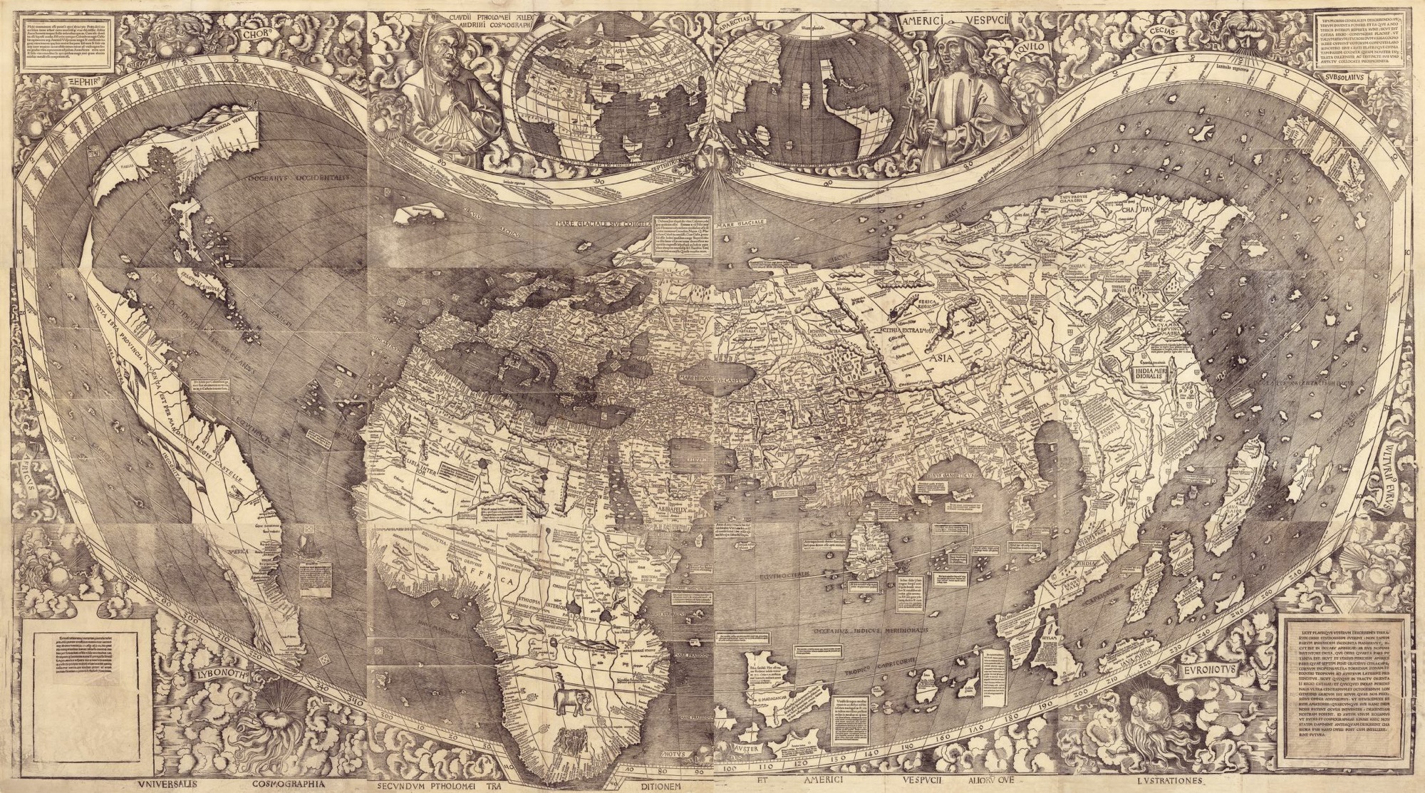
Martin Waldseemüller, “Universalis cosmographia secundum Ptholomaei traditionem et Americi Vespucii alioru[m]que lustrationes”, Francia, 1507, Library of Congress, Geography and Map Division (fonte: loc.gov)
L’archivio, stavolta, è quello della Library of Congress, la Biblioteca del Congresso degli Stati Uniti, che ha messo in rete oltre 36.000 pezzi della propria collezione, che raccoglie esemplari che vanno dal XII secolo fino ad oggi, anche se il periodo più ricco in assoluto di materiale è quello che va dall’800 al ‘900.
Le carte — molte delle quali sono ovviamente relative agli USA — arrivano da tutto il mondo e ci sono anche interi libri, fascicoli, piante cittadine e carte celesti.
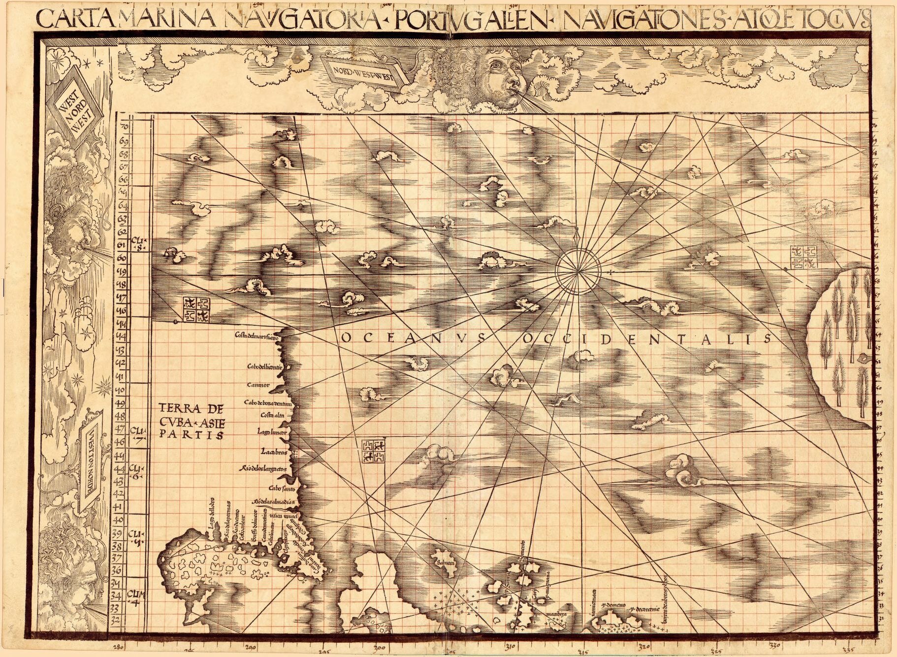
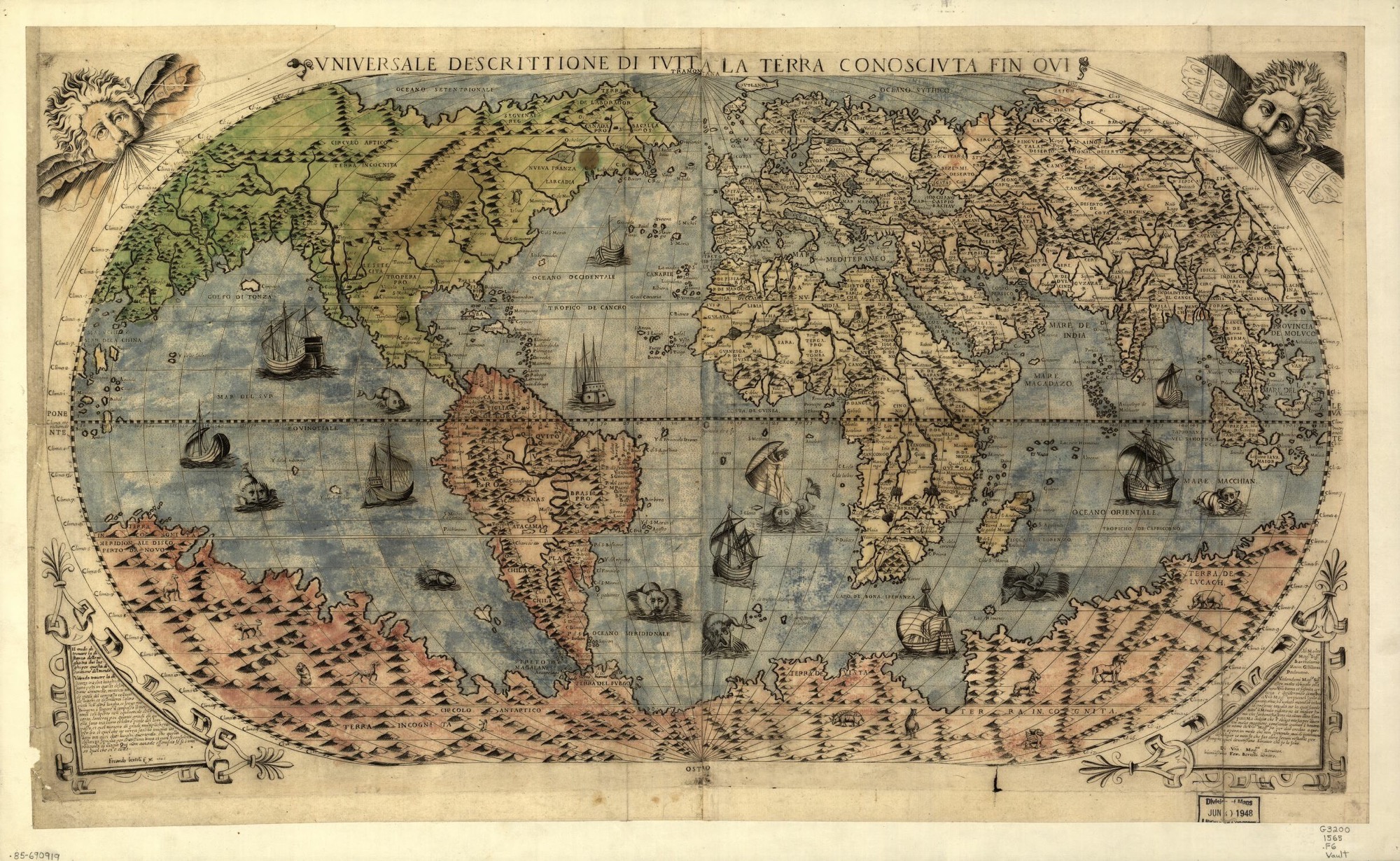
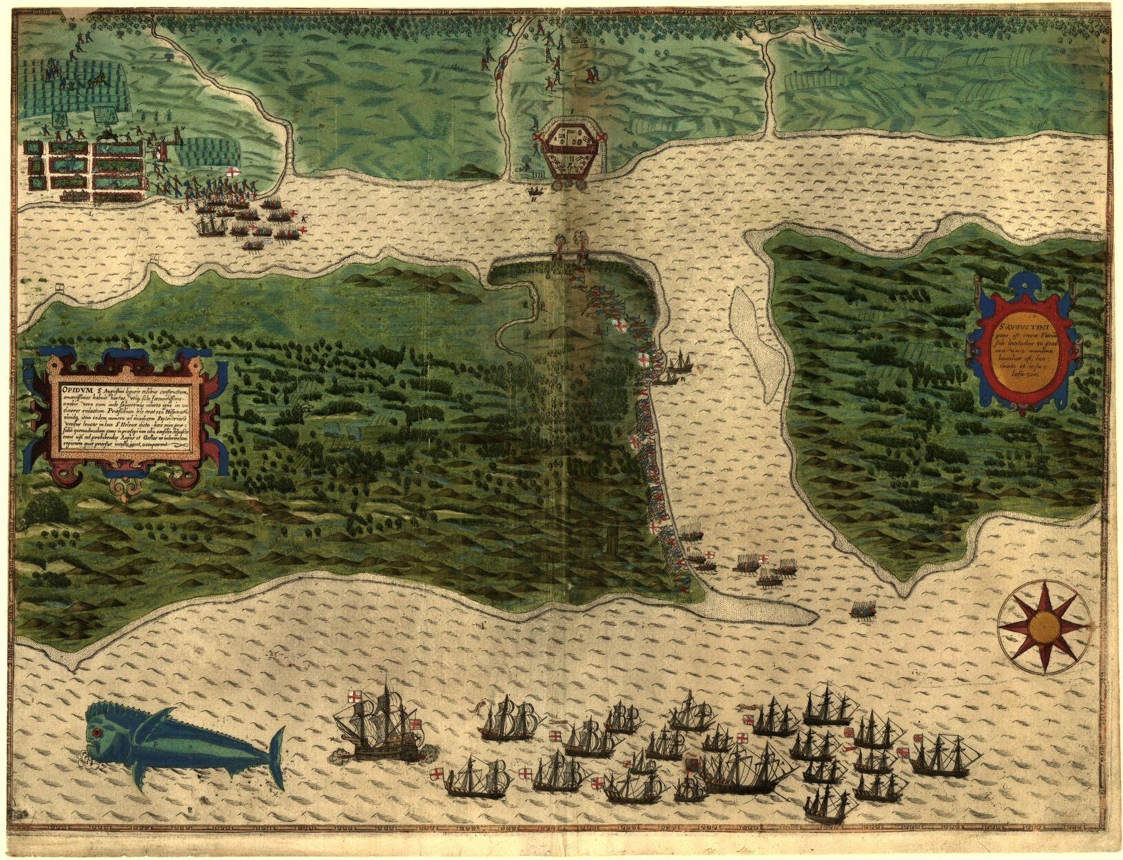
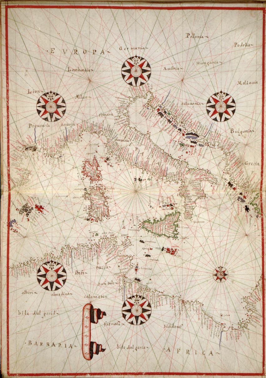
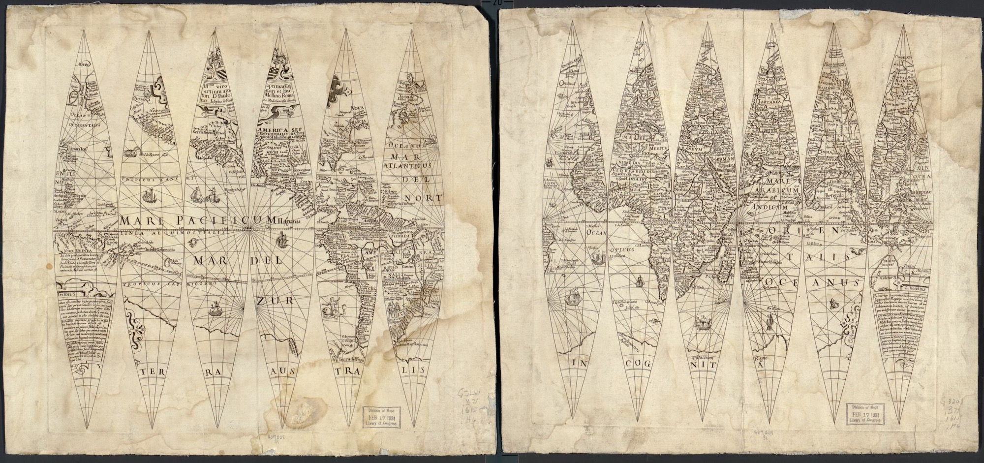
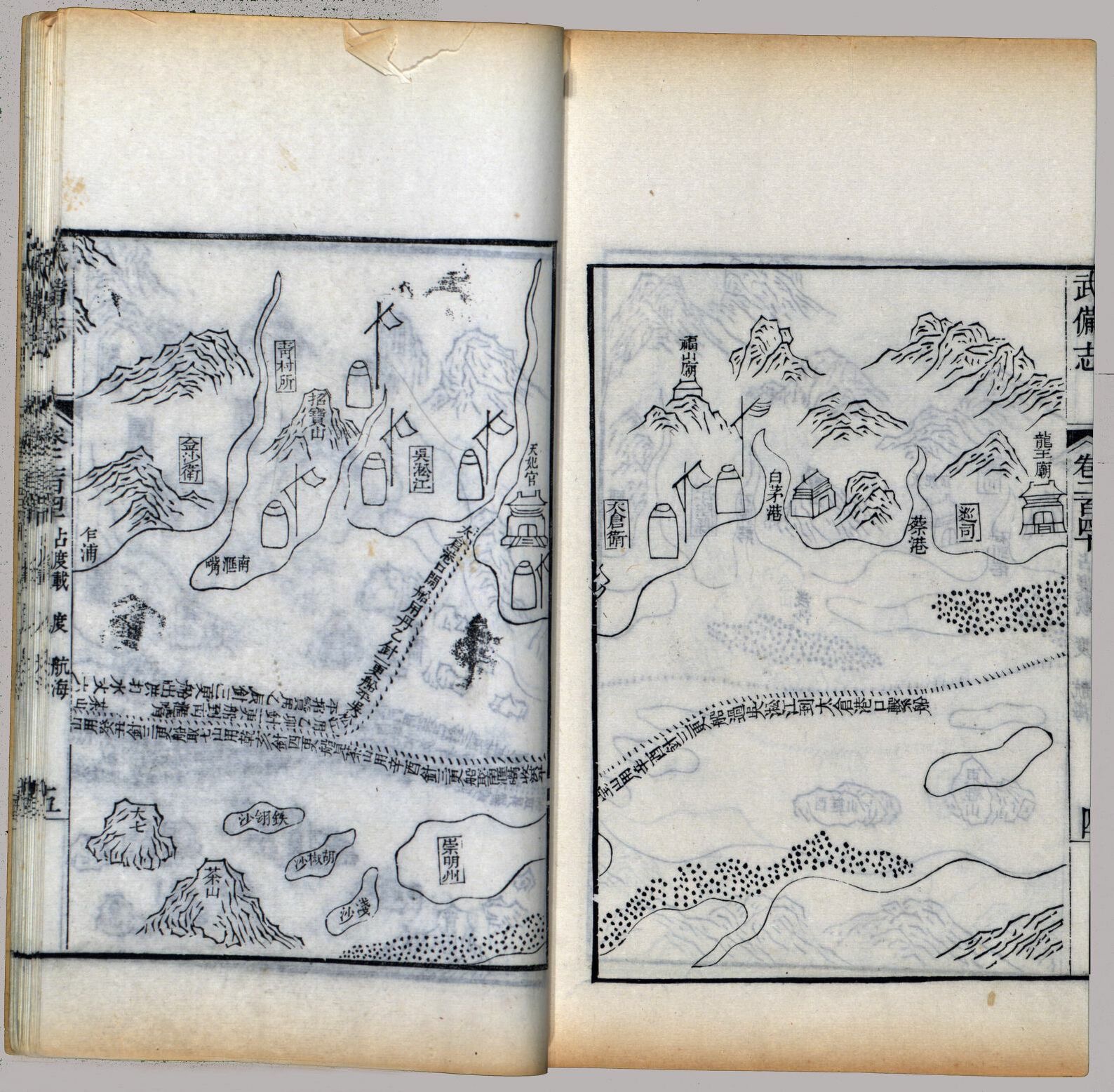
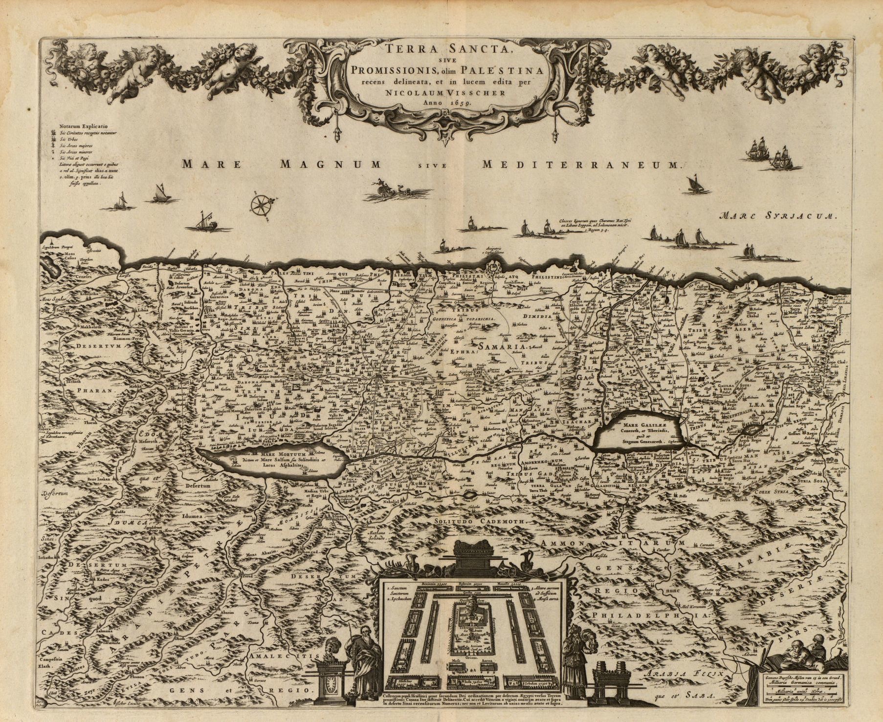
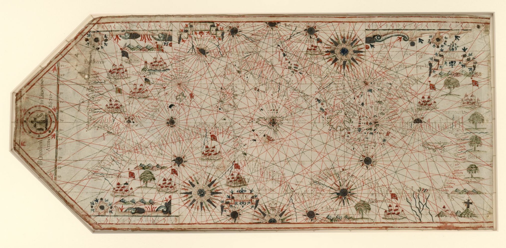
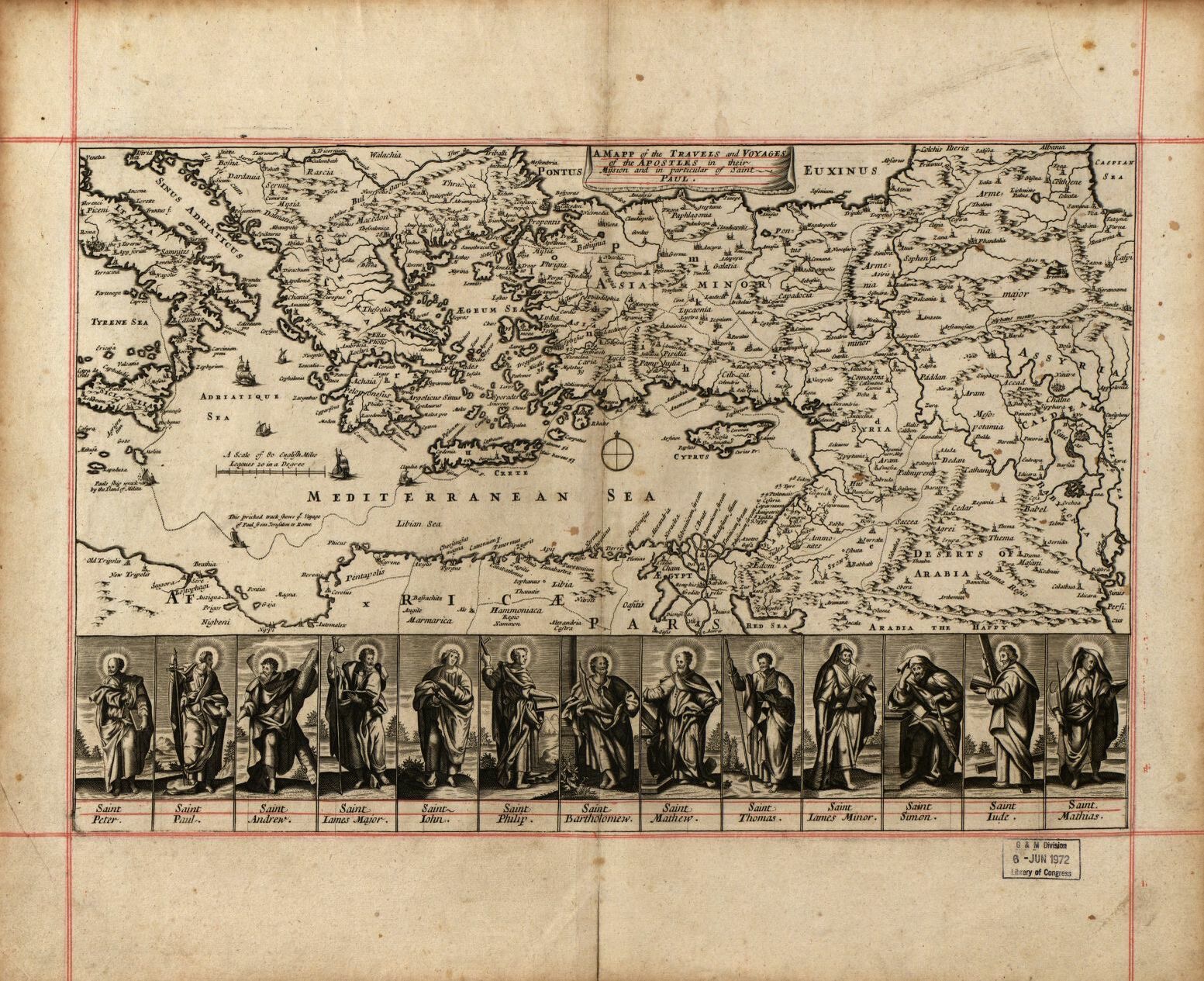
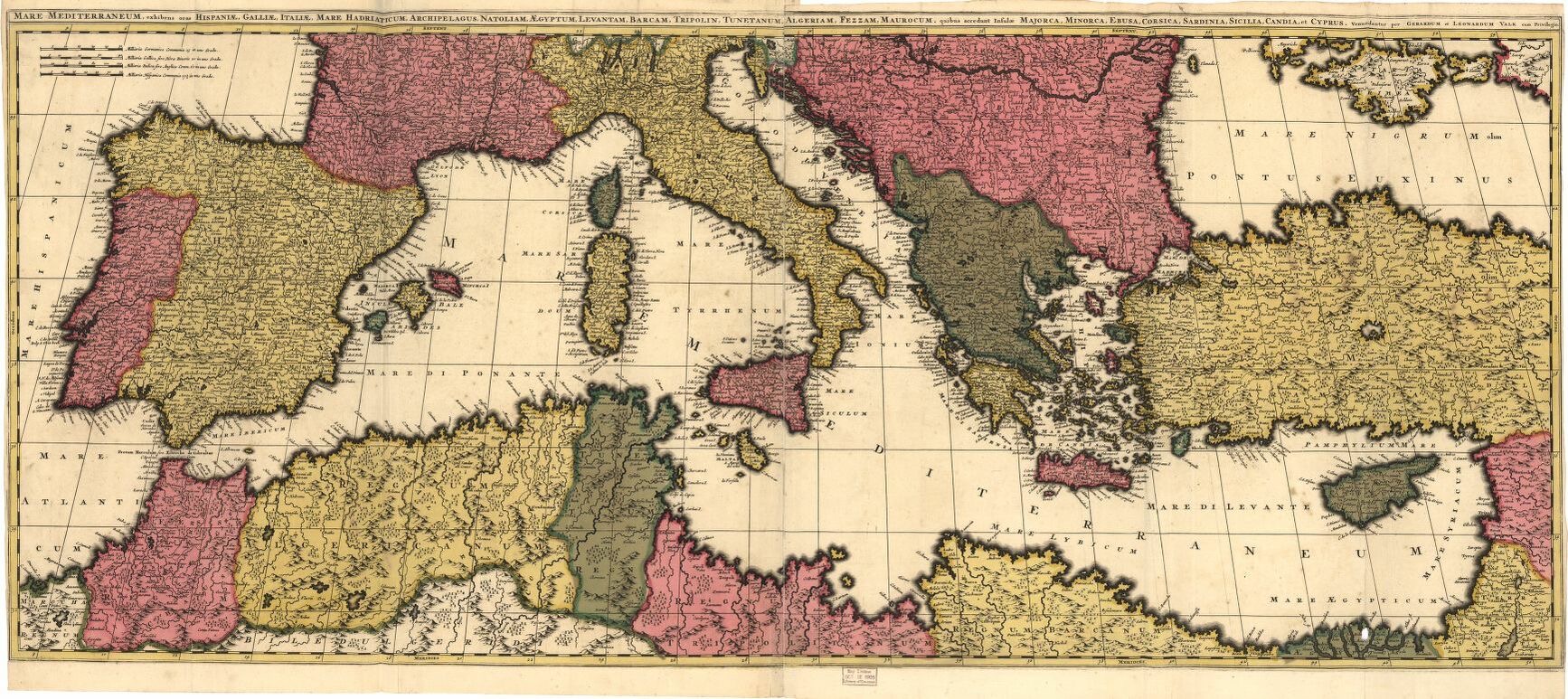
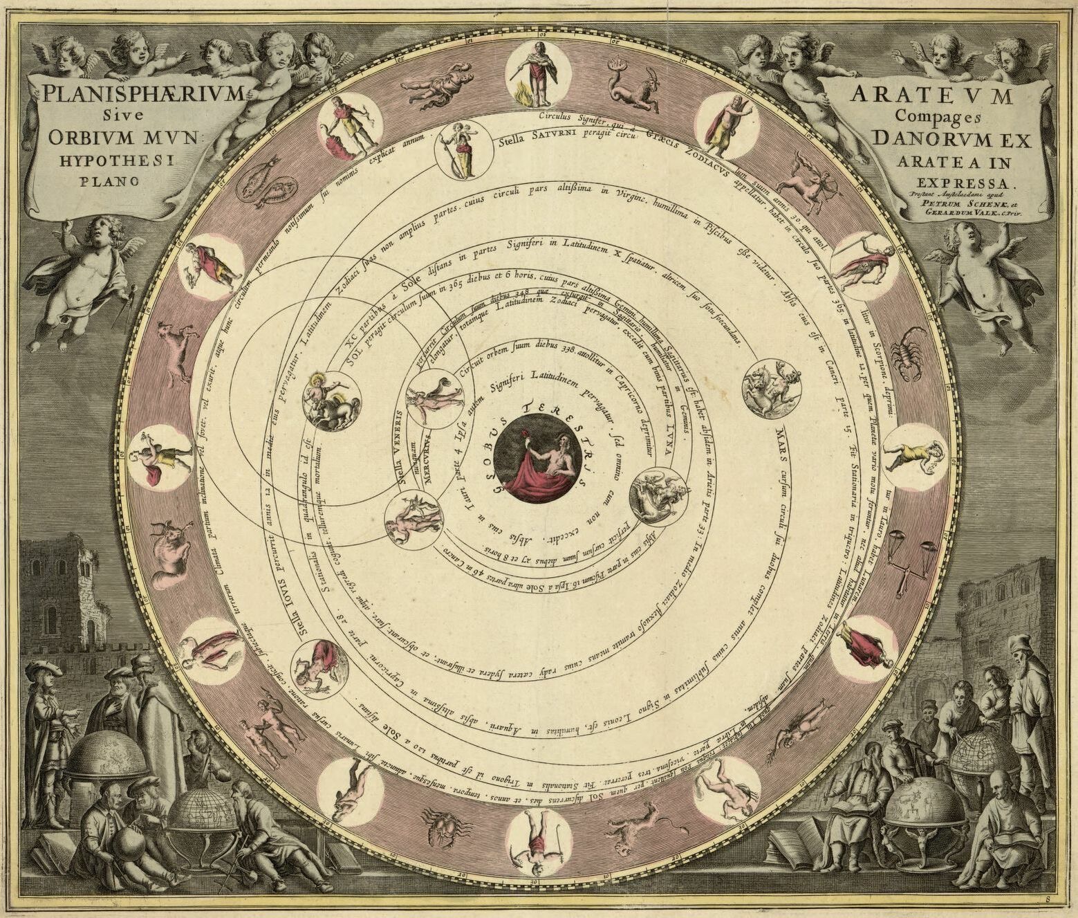
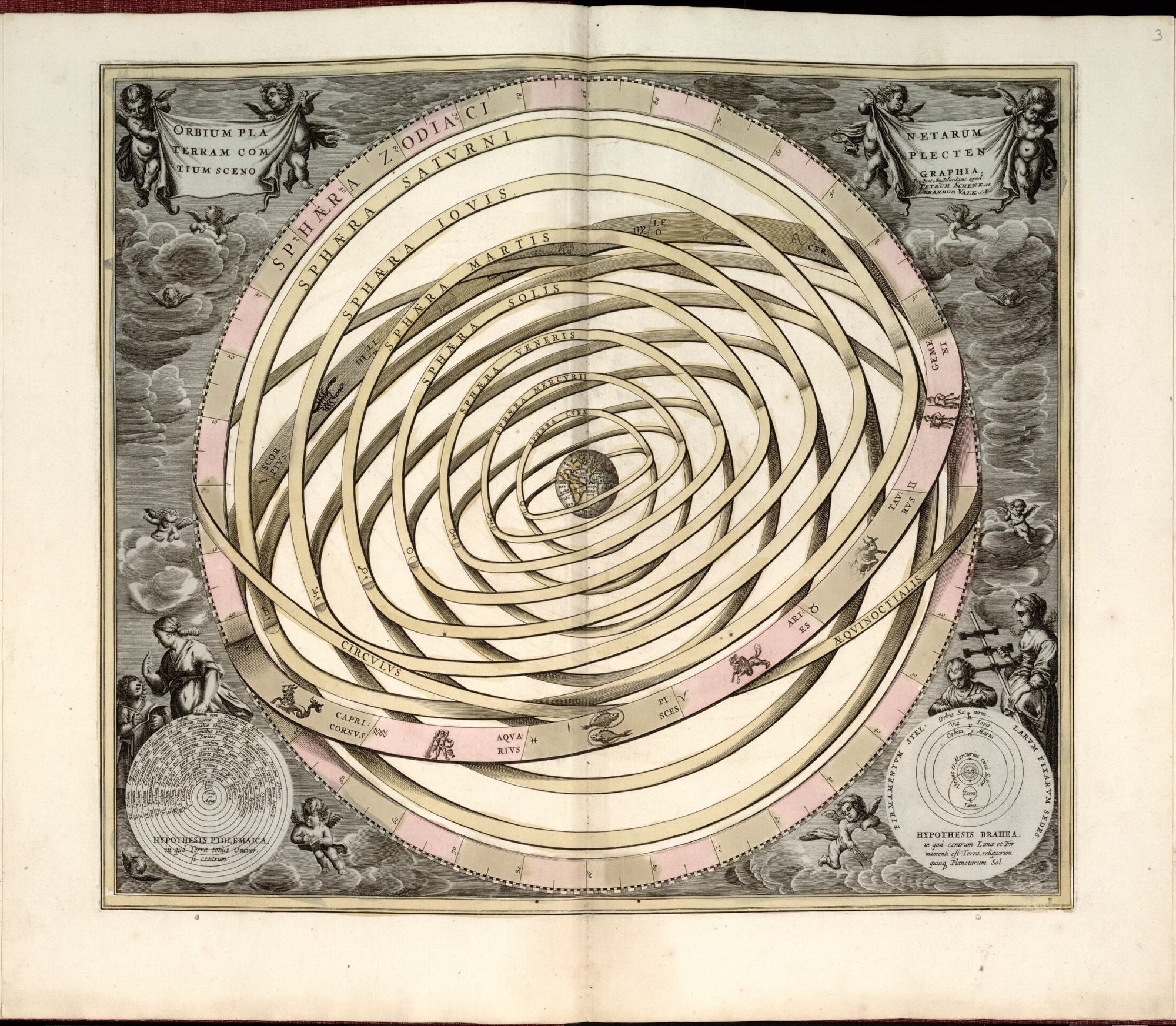
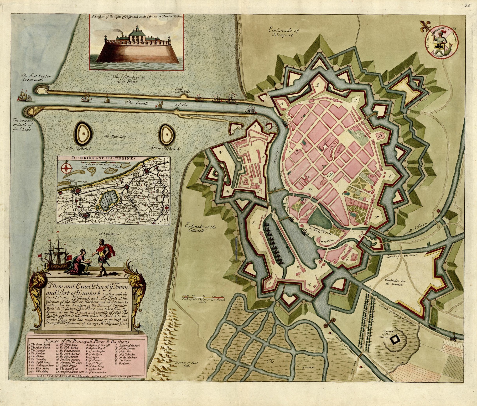
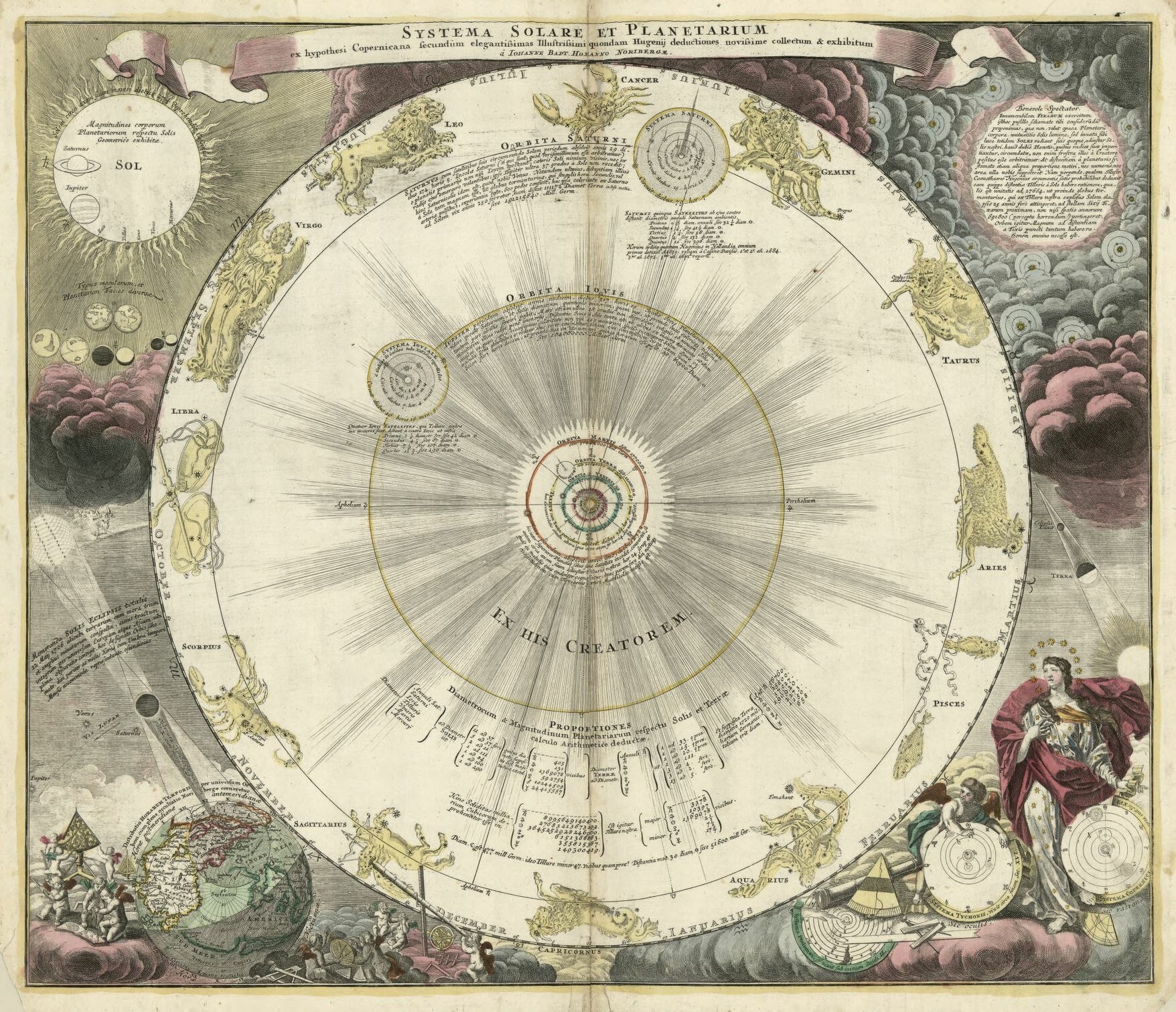
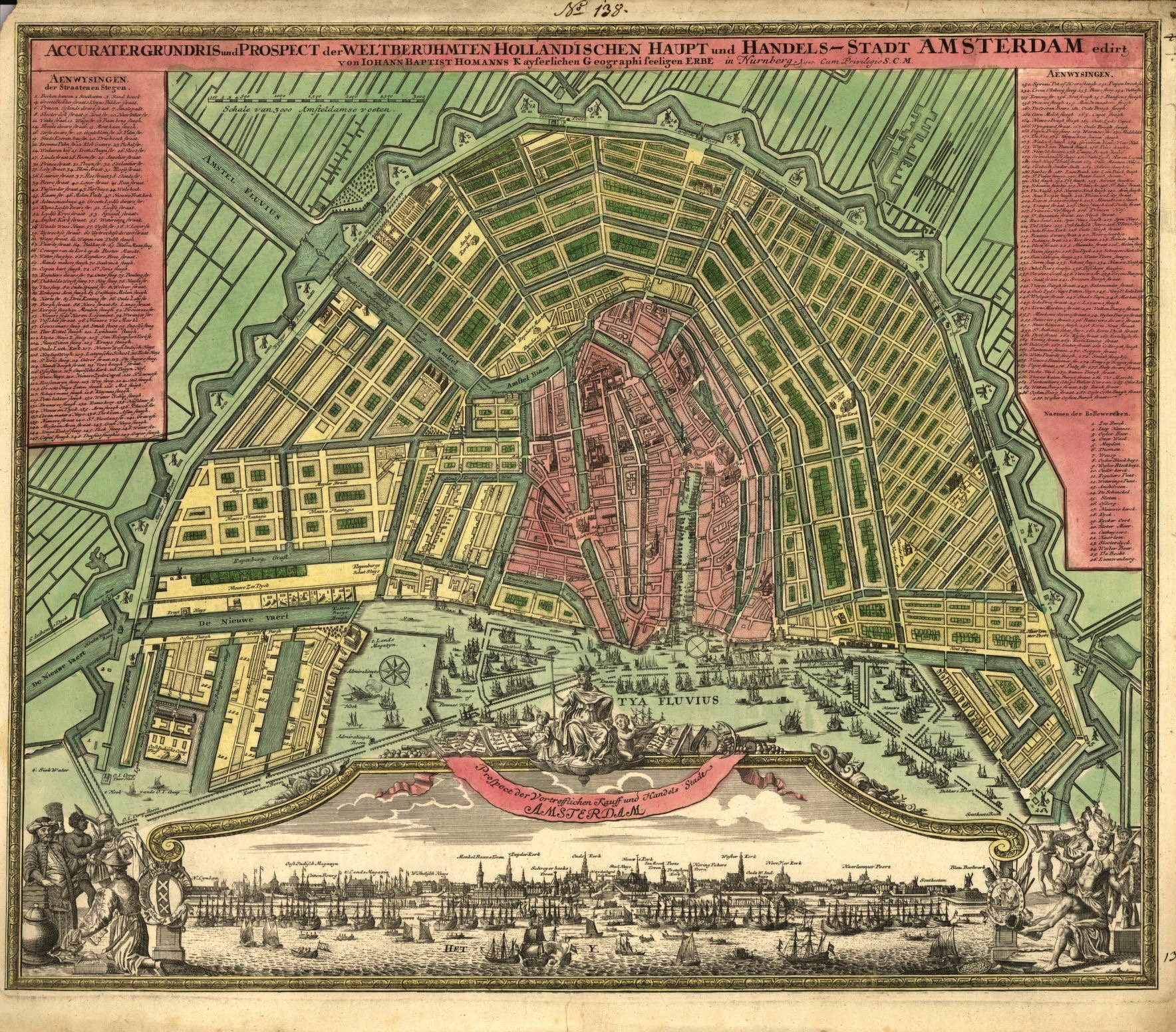
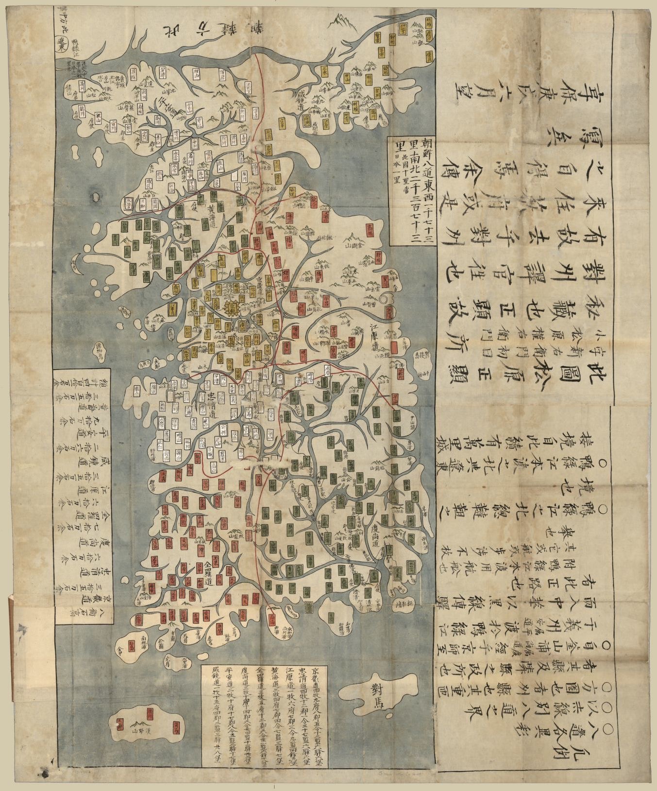
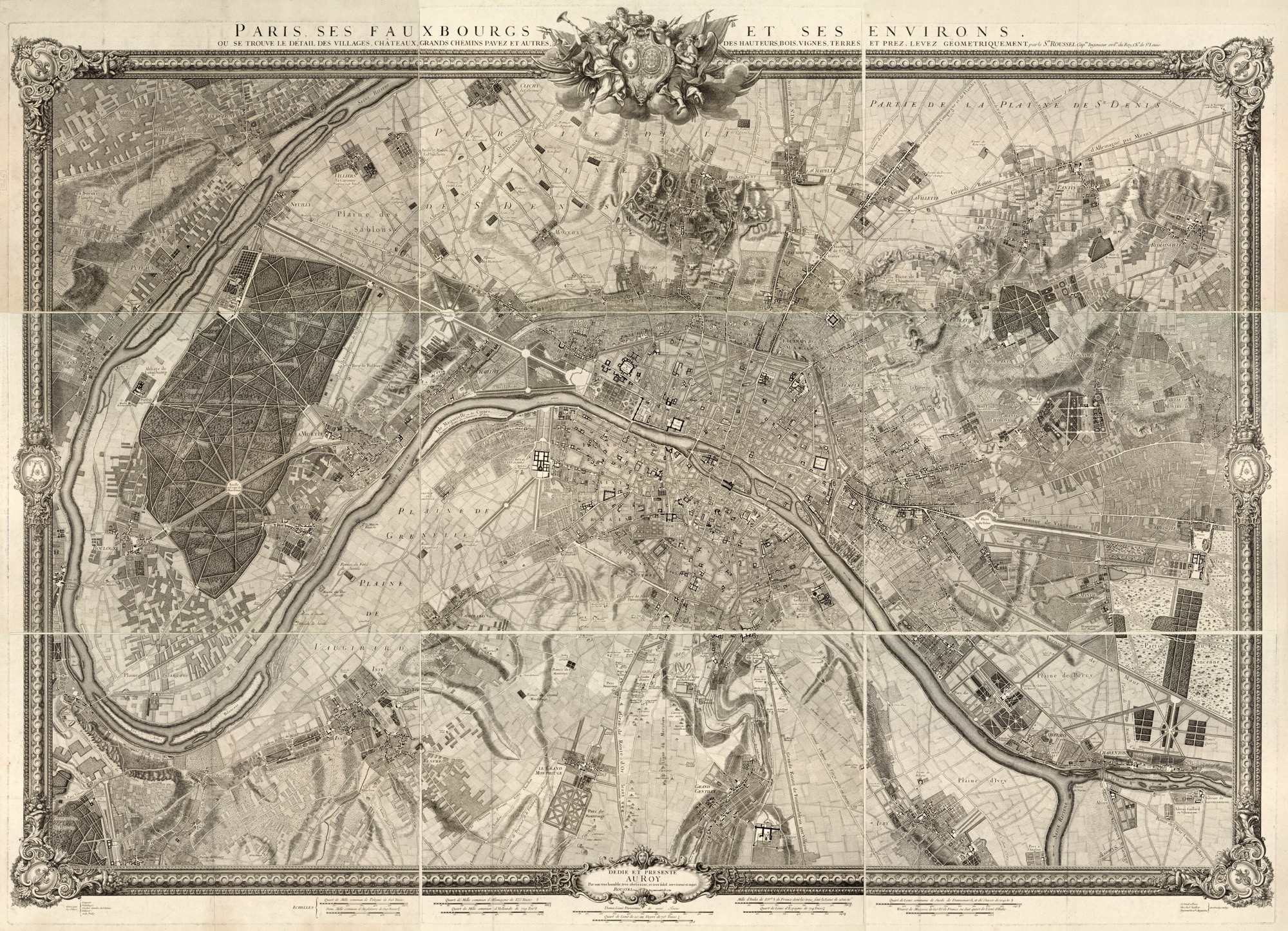
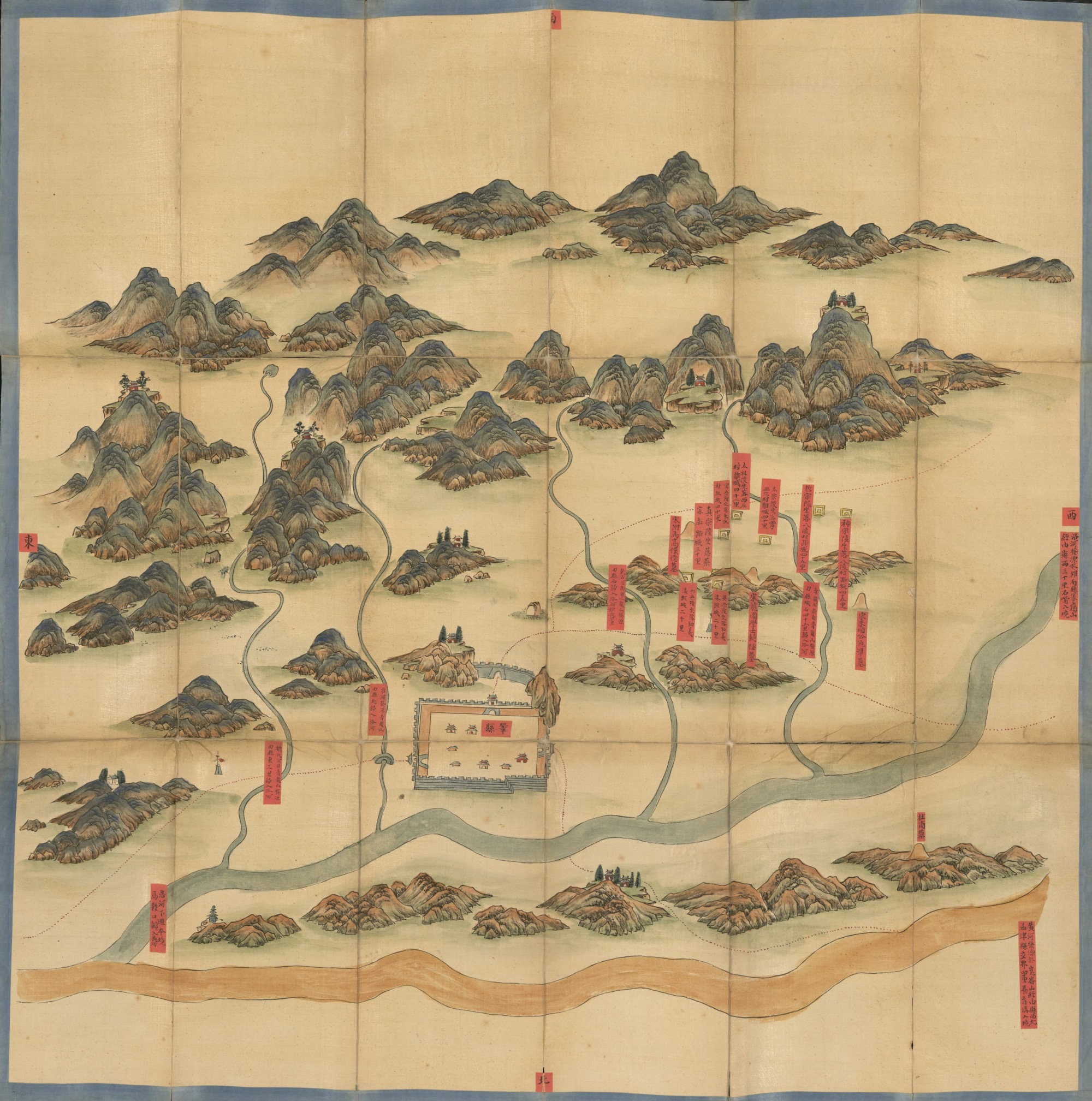
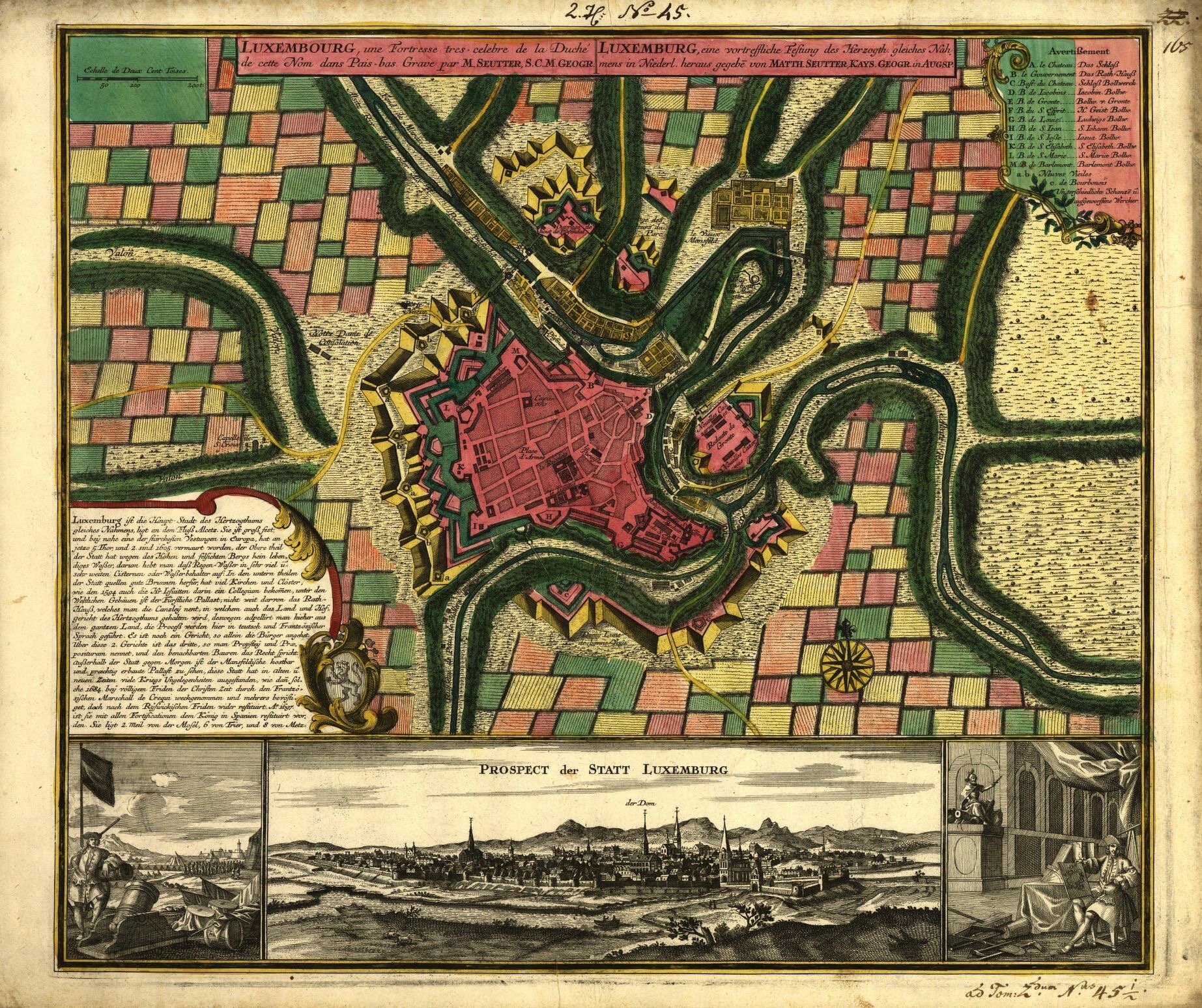
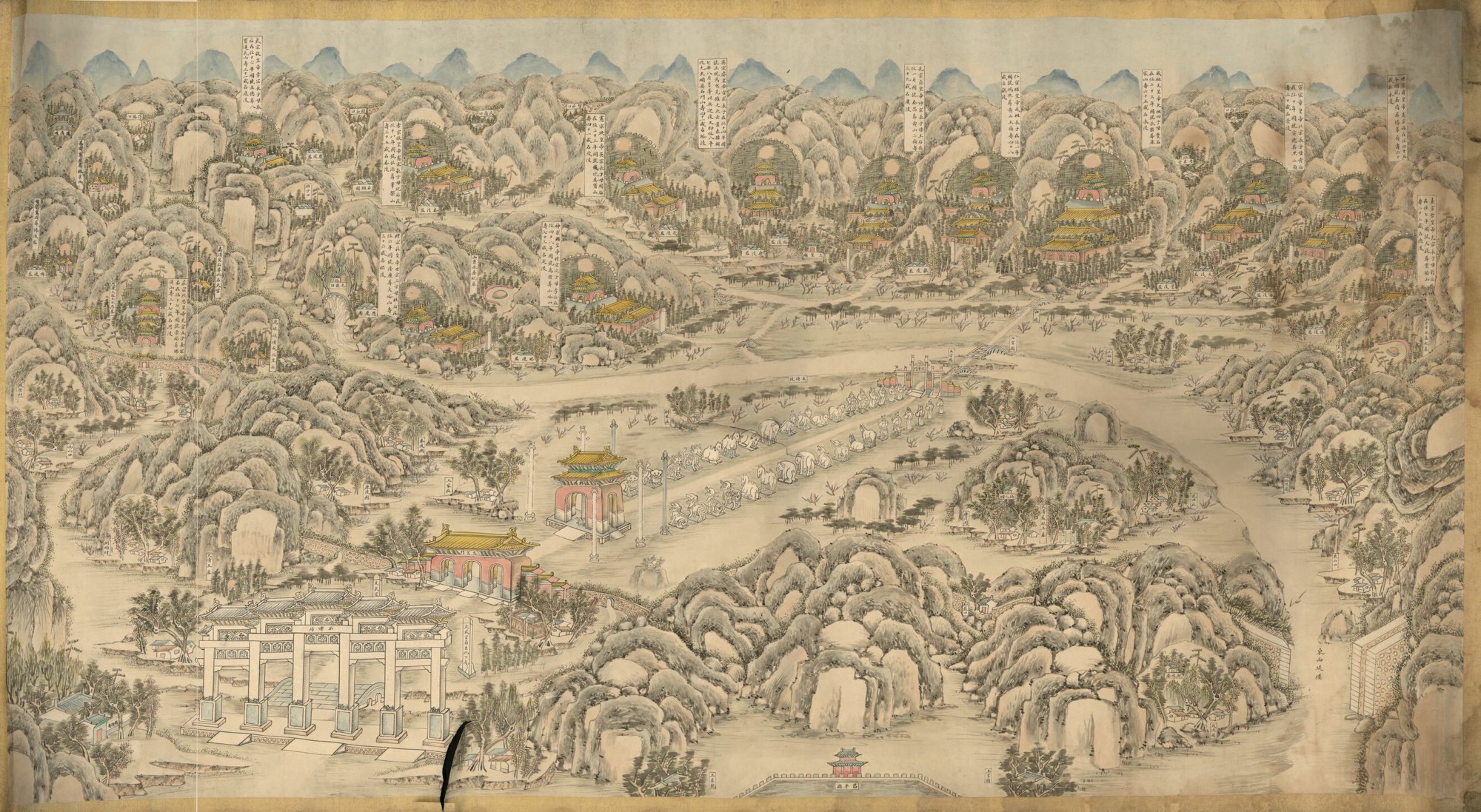
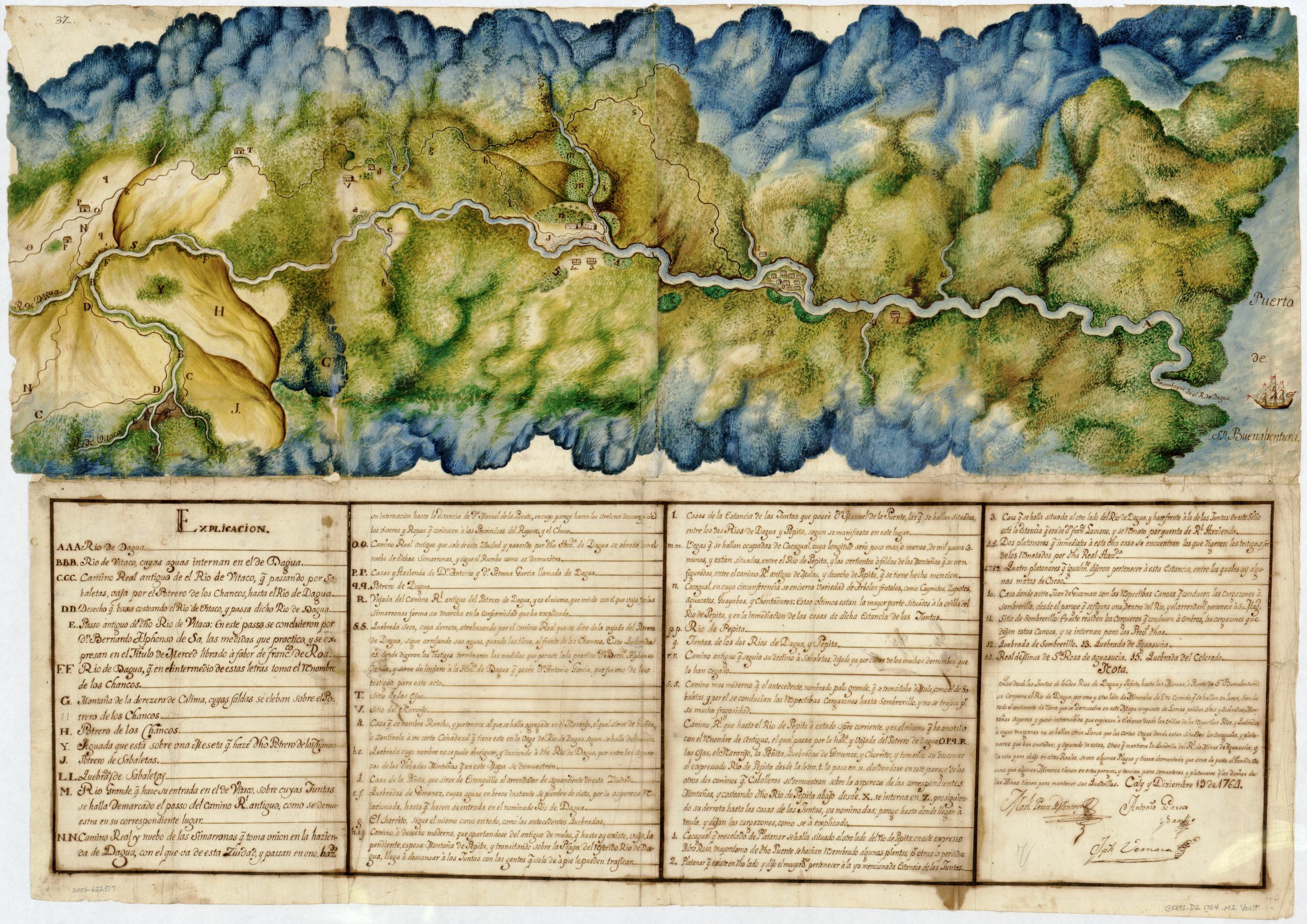
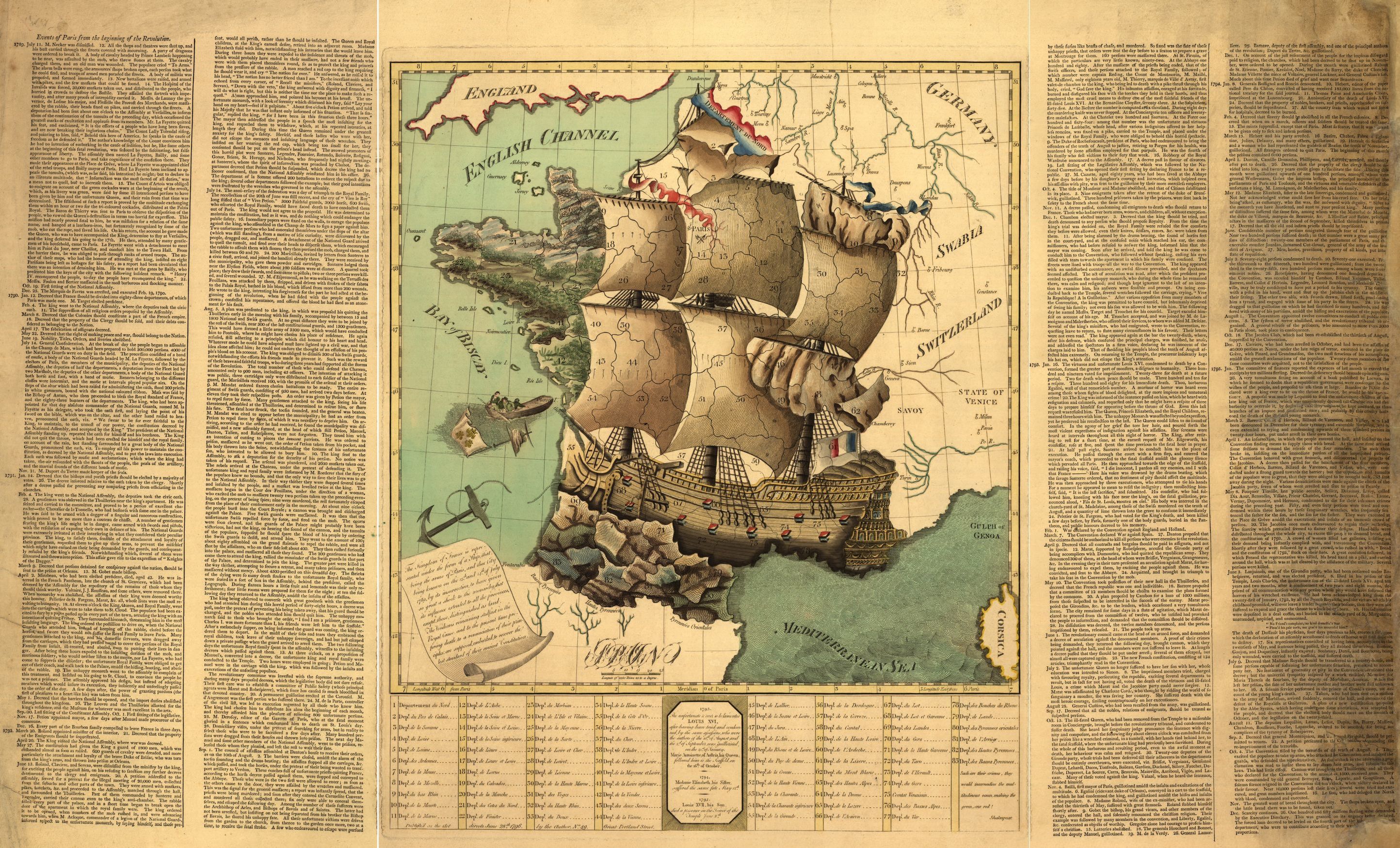
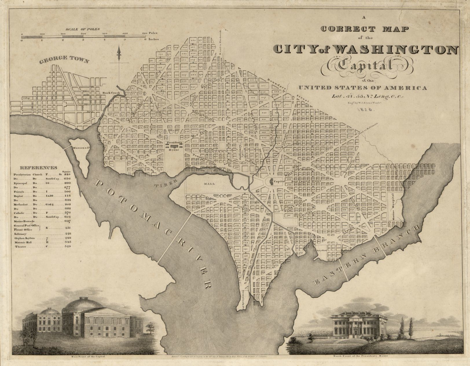
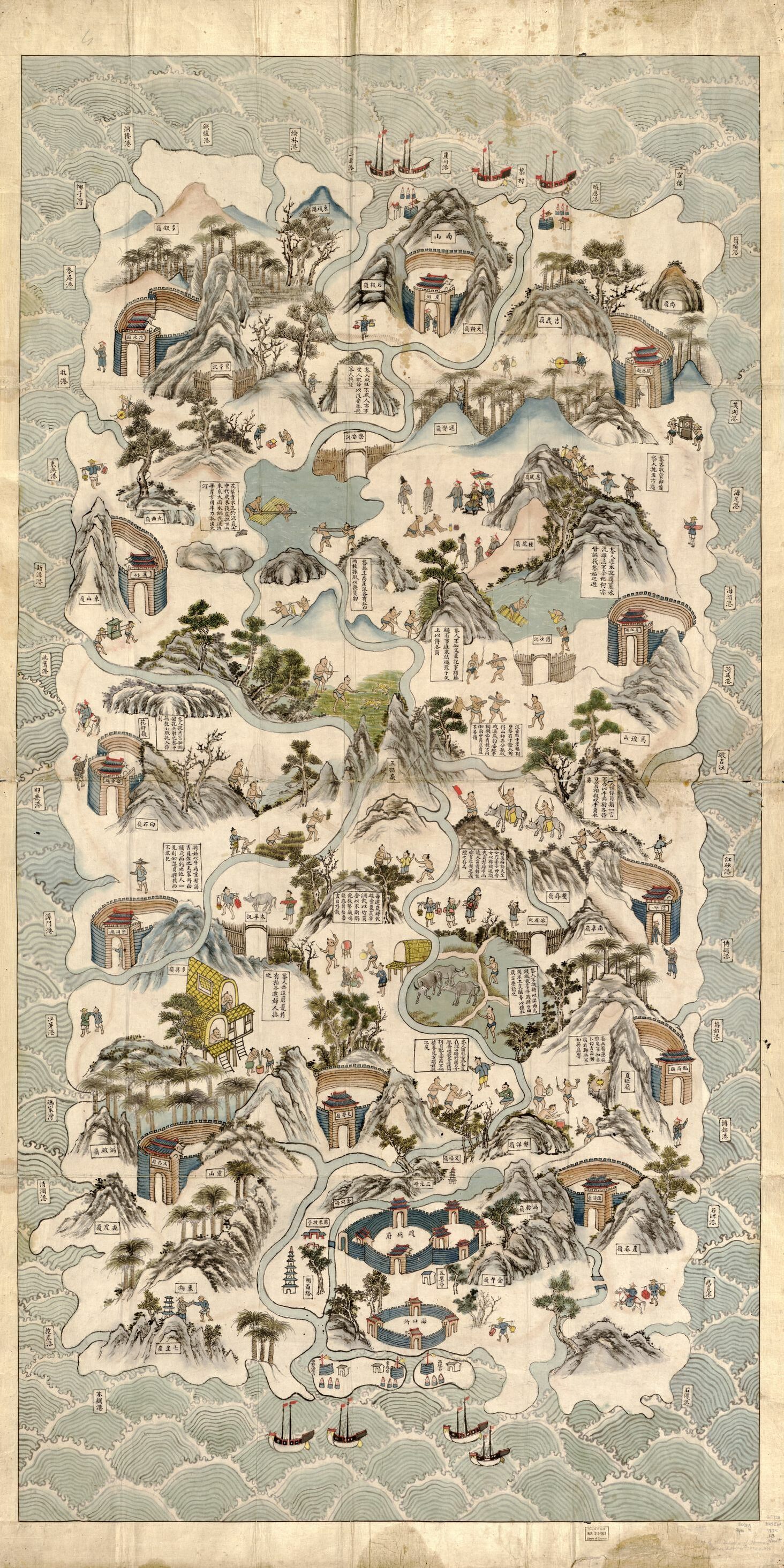
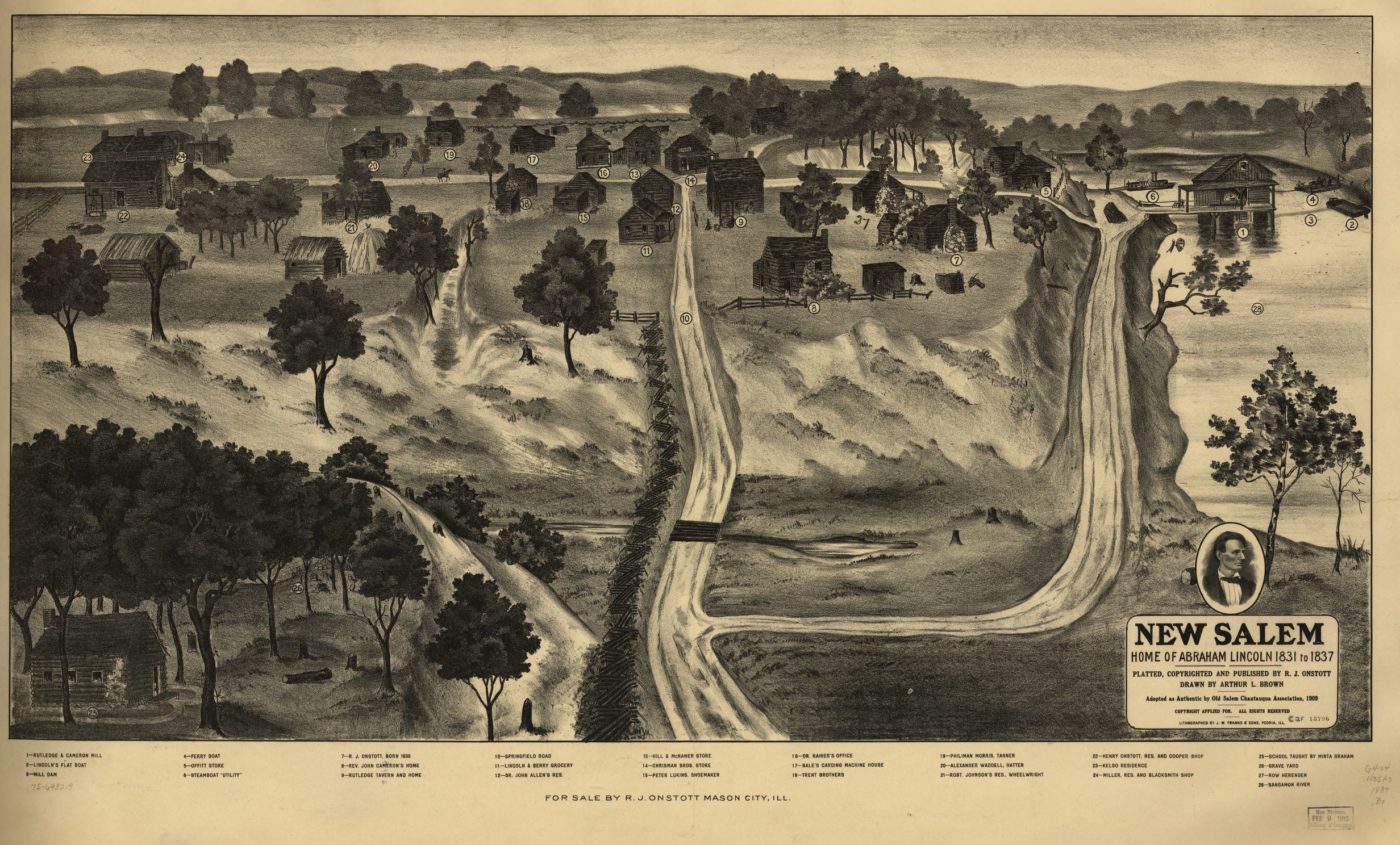
Martin Waldseemüller, Johann Schöner, “Carta marina navigatoria Portugallen navigationes, atque tocius cogniti orbis terre marisque formam naturam situs et terminos nostris temporibus recognitos et ab antiquorum traditione differentes, eciam quor vetusti non meminerunt autore, hec generaliter indicat”, Francia, 1516, Library of Congress, Geography and Map Division (fonte: loc.gov)Paolo Forlani, Ferando Bertelli, Giacomo Gastaldi, “Vniversale descrittione di tvtta la terra conoscivta fin qvi”, Italia, 1565, Library of Congress, Geography and Map Division (fonte: loc.gov)Baptista Boazio, “S. Augustini: pars est terra Florida, sub latitudine 30 grad, ora vero maritima humilior est, lancinata et insulosa”, 1589, Library of Congress, Geography and Map Division (fonte: loc.gov)Joan Oliva, “Portolan atlas of the Mediterranean Sea, western Europe, and the northwest coast of Africa”, 1590 ca., Library of Congress, Geography and Map Division (fonte: loc.gov)Jodocus Hondius, Giuseppe di Rossi, Italia, 1615., Library of Congress, Geography and Map Division (fonte: loc.gov)Yuanyi Mao, “Wu bei zhi”, Cina, 1644 ca., Library of Congress, Geography and Map Division (fonte: loc.gov)Nicolaes Visscher, “Terra sancta sive promissionis, olim Palestina recens delineata, et in lucem edita per Nicolaum Visscher”, Olanda, 1659, Library of Congress, Geography and Map Division (fonte: loc.gov)Giovanni Battista Cavallini, Italia, 1678, Library of Congress, Geography and Map Division (fonte: loc.gov)Richard Blome, “A map of the travels and voyages of the apostles in their mission and in particular of Saint Paul”, UK, 1680, Library of Congress, Geography and Map Division (fonte: loc.gov)Gerard Valck, “Mare mediterraneum, exhibens oras hispaniæ, galliæ, italiæ, mare hadriaticum, archipelagus, natoliam, ægyptum, levantam, barcam, tripolin, tunetanum, algeriam, fezzam, maurocum”, 1695, Library of Congress, Geography and Map Division (fonte: loc.gov)Andreas Cellarius, Peter Schenk, Gerard Valck, “Planisphaerivm Aratevm sive Compages Orbivm Mvndanorvm ex hypothesi Aratea in plano expressa”, Olanda, 1708 ca., Library of Congress, Geography and Map Division (fonte: loc.gov)Andreas Cellarius, Peter Schenk, Gerard Valck, J. van Loon, “Harmonia macrocosmica, seu, Atlas universalis et novus, totius universi creati cosmographiam generalem, et novam exhibens: in quâ omnium totius mundi orbium harmonica constructio, secundum diversas diversorum authorum opioniones, ut et uranometria seu totus orbis coelestis, ac planetarum theoriae, et terrestris globus, tàm planis et scenographicis iconibus, quàm descriptionibus novis ab oculos ponuntur: opus novum, antehac nunquam visum, cujuscunque conditionis hominibus utilissimum, jucundissimum, maximè necessarium, & adornatum”, Olanda, 1708, Library of Congress, Geography and Map Division (fonte: loc.gov)Anna Beeck, Gaspar de Baillieu, “A new and exact plan of ye towne and port of Dunkirk”, 1709, Library of Congress, Geography and Map Division (fonte: loc.gov)Johann Baptist Homann, “Systema solare et planetarium ex hypothesi Copernicana secundum elegantissimas illustrissimi quondam Hugenij deductiones novissime collectum & exhibitum”, Germania, 1716, Library of Congress, Geography and Map Division (fonte: loc.gov)Homann Erben, “Accurater Grundris und Prospect der weltberuhmten Hollandischen Haupt und Handels-Stadt Amsterdam”, Germania, 1727, Library of Congress, Geography and Map Division (fonte: loc.gov)“Chosŏn chido”, Corea, 1730, Library of Congress, Geography and Map Division (fonte: loc.gov)Capitano Roussel, “Paris, ses fauxbourgs et ses environs: où se trouve le détail des villages, châteaux, gands chemins pavez, et autres, des hauteurs, bois, vignes, terres, et prez, levez géometriquement”, Francia, 1733, Library of Congress, Geography and Map Division (fonte: loc.gov)“Gong Xian he tu”, Cina, tra il 1734 e il 1779, Library of Congress, Geography and Map Division (fonte: loc.gov)Matthaeus Seutter, “Luxembourg, une fortresse tres-celebre de la duché de cette nom dans Pais-Bas”, Germania, 1730 ca., Library of Congress, Geography and Map Division (fonte: loc.gov)“Ming shi san ling tu”, Cina, 1736 ca., Library of Congress, Geography and Map Division (fonte: loc.gov)“Manuscript map of Dagua River region, Colombia”, Colombia, 1764, Library of Congress, Geography and Map Division (fonte: loc.gov)“The Kingdom of France is represented under the form of a ship”, UK, 1796, Library of Congress, Geography and Map Division (fonte: loc.gov)William James Stone, Peter Force, Davis & Force, “A correct map of the city of Washington: capital of the United States of America: lat. 38.53 n., long. 0.0”, USA, 1820., Library of Congress, Geography and Map Division (fonte: loc.gov)“Qiong Jun di yu quan tu”, Cina, 1836 ca., Library of Congress, Geography and Map Division (fonte: loc.gov)Arthur L. Brown, R. J. Onstott, J.W. Franks & Sons, “New Salem, home of Abraham Lincoln 1831 to 1837”, USA, 1909., Library of Congress, Geography and Map Division (fonte: loc.gov)
Ogni settimana inviamo un riassunto di quanto pubblicato sul sito
Un messaggio
Frizzifrizzi è sempre stato e sempre rimarrà gratuito. Si tratta di un progetto realizzato ogni giorno con amore e con impegno. La volontà è di continuare a farlo cercando di tenere al minimo la pubblicità. Per questo ti chiediamo una mano — se vorrai — con una piccola donazione. Potrai farla su PayPal.
Grazie di cuore.
Gestisci Consenso Cookie
Per fornire le migliori esperienze, utilizziamo tecnologie come i cookie per memorizzare e/o accedere alle informazioni del dispositivo. Il consenso a queste tecnologie ci permetterà di elaborare dati come il comportamento di navigazione o ID unici su questo sito. Non acconsentire o ritirare il consenso può influire negativamente su alcune caratteristiche e funzioni.
Funzionale
Sempre attivo
L'archiviazione tecnica o l'accesso sono strettamente necessari al fine legittimo di consentire l'uso di un servizio specifico esplicitamente richiesto dall'abbonato o dall'utente, o al solo scopo di effettuare la trasmissione di una comunicazione su una rete di comunicazione elettronica.
Preferenze
L'archiviazione tecnica o l'accesso sono necessari per lo scopo legittimo di memorizzare le preferenze che non sono richieste dall'abbonato o dall'utente.
Statistiche
L'archiviazione tecnica o l'accesso che viene utilizzato esclusivamente per scopi statistici.L'archiviazione tecnica o l'accesso che viene utilizzato esclusivamente per scopi statistici anonimi. Senza un mandato di comparizione, una conformità volontaria da parte del vostro Fornitore di Servizi Internet, o ulteriori registrazioni da parte di terzi, le informazioni memorizzate o recuperate per questo scopo da sole non possono di solito essere utilizzate per l'identificazione.
Marketing
L'archiviazione tecnica o l'accesso sono necessari per creare profili di utenti per inviare pubblicità, o per tracciare l'utente su un sito web o su diversi siti web per scopi di marketing simili.